Description of ladscape types and mineral resources of China
China is located in the eastern part of Eurasian continent, occupying the territory of 9,600,000 km2. The Chinese land frontier is 22,800 km long. China borders on the PDRK (1416 km) from north-east; on the RF (3,605 km and 40 km) from north-east and north, on Mongolia (4673 km) from north; on Kazakhstan (1,533 km) and Kyrgyzstan (858 km) from north-west; on Tajikistan (414 km), Afghanistan (76 km), Pakistan (523 km) from west; on India (3,380 km) from south-west and south; on Nepal (1,236 km), Bhutan (470 km), Myanmar (2,185 km), Laos (423 km) and Vietnam (1,281 km) from south. From east and south east, China has maritime boundaries with the Republic of Korea, Japan, Philippines, Brunei, Malaysia and Indonesia.
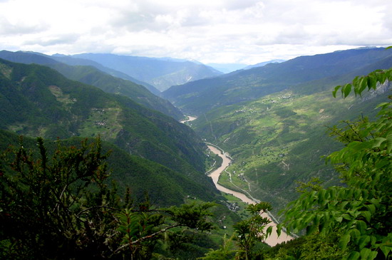
The CPR territory stretching from Pamir to the Pacific Ocean shores and from the Amur to the South Chinese Sea features a wide variety of natural conditions, diversity of landscapes, richness of earth interiors, conditioned by complicated relief and unusual position of the country in the belt of most sharply manifested fight of oceanic and continental influences at the border of different climatic zones.
The highest locality in China is Quinghai-Tibetan Plateau, located at the height of 4,000 m above sea level. It is a location place of the Himalayas ridge with its main 8,849-m high peak Chomolungma, which is more often called as “world’s top” “the world’s peak”. The lowest place in China is located at the depth of 200 m below sea level.

China is represented by most various types of lands: plough-land, forests, steppes, deserts, sand banks, mountainous regions and plateaus. The latter occupy the western part of the country, the west and north of China is occupied by steppes and deserts, and the east – by plough-lands. In its turn, forest zones are located in the north-east and south-west of China. The forests in China occupy 128,630,000 ha. In the south-west of China in Yunnan province, there is the locality of Xishuangbanna. It is impenetrable jungles of tropical plants, numbering over 5,000 species, is rightly called “kingdom of plants”.
There are over 1,500 rivers with total length exceeding 1000 square kilometers in the territory of China. China has outland rivers (Yangtze, Hwang Ho, Heilongjiang, Zhu Jiang River, Liao River, Hai River, Huai River and other rivers, flowing west-east and falling into the Pacific ocean seas) and inland ones (falling into lakes). The largest river in China is Yangtze – the world’s third largest one after the Amazon in South America and Nile in Africa. Its length is 6300 km. The Yangtze is followed by the Hwang Ho with total length of 5,464 m. It is here where 5,000 years ago the Chinese civilization was originated. Along with large rivers, there are a lot of small ones in the territory of China.
China is rich in mineral resources: coal, natural gas, metals. The metals are divided into ferrous – iron, manganese, vanadium, titanium and non-ferrous ones – all the types of the non-ferrous metals existing in the world. China is the world’s third country in mineral reserves.


